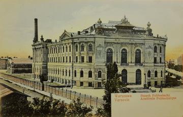
History
On June 30, 1921, Polish Minister of Religion and Public created the Faculty of Surveying at the Warsaw University of Technology. 38 candidates were accepted for the first academic year 1921/22. The study program included a comprehensive lecture in mathematics as a basis for higher surveying and encyclopedic knowledge in all fields necessary for every engineer. In 1922, the first two chairs were created: ordinary Surveying I and extraordinary Surveying II (later: Fundamentals of Geodesy).
In 1925 the Faculty of Surveying has been renamed to Faculty of Geodesy. The same year, the third Chair of Practical Astronomy has been established. And in the 1925/26 academic year, the first diplomas of a surveyor engineer were handed out to graduates.
In the years 1925-1945 318 engineers including 7 women graduated from the Faculty. The first women graduated in 1929/30.
After the World War II outbreak, the activity of the Warsaw University of Technology, including the Faculty of Geodesy, was suspended. However, the training of geodetic staff continued - underground. 21 graduates completed these studies.
In February 1945, the reconstruction of the Warsaw University of Technology began. At the beginning of the, the Faculty of Geodesy began to work at the beginning of the 1945/1946 academic year. In 1947, the Warsaw University of Technology Astronomical and Geodetic Observatory in Józefosław near Warsaw has been established. Since it cooperates with international centers dealing with geodynamics and observation of artificial satellites of the Earth.
By order of the Minister of Higher Education of April 29, 1954, the Faculty of Geodesy changed its name to the Faculty of Geodesy and Cartography, which it helds till this day. At that time, the Faculty was reorganized, and the following departments were created: Fundamentals of Geodesy, Geodetic Detailed Surveying, Geodetic Astronomy, Geodetic Arrangement of Agricultural and Forest Areas Higher Geometry, Cartography, Engineering and Industrial Geodesy, and Geodetic Calculations. The Council of the Faculty of Geodesy and Cartography awarded the professional degrees of master of geodesy in 6 specializations.
At the end of the sixties, construction of the Training Center in Grybów began, which is a testing ground in both didactics and scientific research to this day.
From the beginning of the 1970/71 academic year, the Faculty of Geodesy and Cartography changed the organizational structure. In place of the Cathedrals, three institutes were established: the Institute of Higher Geodesy and Geodetic Astronomy, the Institute of Photogrammetry and Cartography and the Institute of Industrial Geodesy.
In 2005, together with the Faculty of Architecture, the new field of study – Spatial Management – has been launched. And in 2015, in order to meet the needs of the modern economy in 2015, another one – Geoinformatics – has been started. Therefore, the Faculty currently conducts studies in three fields: Geodesy and Cartography, Spatial Management, and Geoinformatics.
In 2007-2009, major changes in the structure of the Faculty took place: institutes were dissolute and six new units were established instead: Chair of Geodesy and Geodesy Astronomy, Chair of Spatial Management and Environmental Sciences, Chair of Engineering Geodesy and Survey-Control Systems, Department of Photogrammetry, Remote Sensing and Spatial Information Systems, Department of Cartography and Department of Cadastre and Real Estate Management. This structure of the Faculty has been functioning until now.

